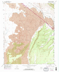
1957 Map of Grants SE
USGS Topo · Published 1973About this map
The Malpais dominates this landscape, revealing a frozen expanse of lava flows that define the geological character of the region. The volcanic terrain is flanked by the towering Las Ventanas Ridge to the east and Horace Mesa to the northeast. Human passage through this environment is dictated by the corridor of the Atchison Topeka and Santa Fe Railroad, which follows the path of the Rio San Jose through the canyon at El Cañoncito. Water sources are sparse but critical markers on the map, including Laguna del Chical and Rancho del Padre Spring. Much of the eastern and southern territory is situated within the Acoma Pueblo Indian Reservation and Grant Boundary, where the map documents infrastructure like a Microwave Station and various jeep trails crossing the desert floor.
Find a feature on this map
20 named features on this map. Tap any name to fly to it.
Don’t see what you’re looking for? This feature index may not catch every label — zoom into the map to look around manually.
Map Details
Editions of this 1957 Grants SE Map
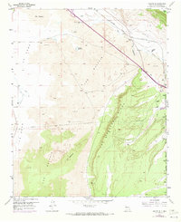
Other maps of this area

1883 · Mt. Taylor
USGS Topo · 1:250,000

1886 · Mt. Taylor
USGS Topo · 1:250,000

1892 · Mt. Taylor
USGS Topo · 1:250,000

1899 · Mt. Taylor
USGS Topo · 1:250,000

1917 · Broom Mountain
USGS Topo · 1:125,000

1954 · Socorro
USGS Topo · 1:250,000

1957 · San Rafael
USGS Topo · 1:24,000

1957 · Lobo Springs
USGS Topo · 1:24,000

1957 · Grants SE
USGS Topo · 1:24,000

1957 · Mc Cartys
USGS Topo · 1:24,000