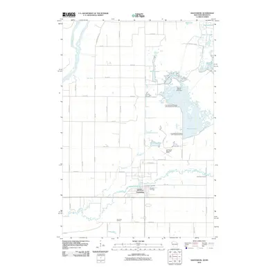
2010 Map of Grantsburg
USGS Topo · Published 2010About this map
Grantsburg serves as the central hub of this northern Wisconsin landscape, situated near the confluence of local waterways. The village is defined by its relationship to the Wood River, which winds south of the town center near Memory Lake 152 and the Hickerson 1895C98 Dam. To the northwest, the Saint Croix River and Kettle River create a complex riparian border, while the eastern portion of the quadrangle is dominated by the extensive wetlands and managed pools of the Crex Meadows area, including Phantom Lake and the South River Flowage.
Find a feature on this map
60 named features on this map. Tap any name to fly to it.
Don’t see what you’re looking for? This feature index may not catch every label — zoom into the map to look around manually.
Map Details
Editions of this 2010 Grantsburg Map
This is the sole edition of this map. No revisions or reprints were ever made.
Other maps of this area

1950 · Rush City
USGS Topo · 1:48,000

1950 · Grantsburg
USGS Topo · 1:48,000

1951 · Milltown
USGS Topo · 1:48,000

1953 · Stillwater
USGS Topo · 1:250,000

1955 · Rush City
USGS Topo · 1:62,500

1955 · Milltown
USGS Topo · 1:62,500

1955 · Stillwater
USGS Topo · 1:250,000

1958 · Stillwater
USGS Topo · 1:250,000

1961 · Pine City
USGS Topo · 1:62,500

1962 · Grantsburg
USGS Topo · 1:62,500