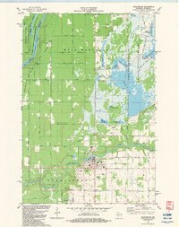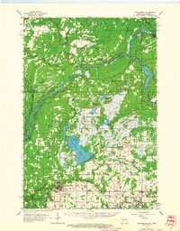
1962 Map of Grantsburg
USGS Topo · Published 1964About this map
Grantsburg serves as the primary hub of this 1960s river landscape, where the ST Croix River forms the winding boundary between Wisconsin and Minnesota. The terrain is defined by a sophisticated system of water management and conservation, evident in the expansive Crex Meadows State Wildlife Area and numerous man-made impoundments like Phantom Flowage and Munson Flowage. These features illustrate the mid-century transition of the region from purely extractive land use toward wildlife management and recreation.
Find a feature on this map
64 named features on this map. Tap any name to fly to it.
Don’t see what you’re looking for? This feature index may not catch every label — zoom into the map to look around manually.
Map Details
Editions of this 1962 Grantsburg Map
This is the sole edition of this map. No revisions or reprints were ever made.
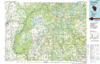
Historical Maps of Grantsburg Through Time
9 maps found