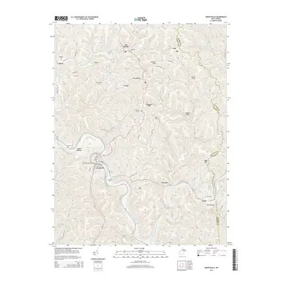
2014 Map of Grantsville
USGS Topo · Published 2014About this map
Grantsville serves as the primary hub of activity in this 2014 survey of central West Virginia, positioned where the Little Kanawha River winds through the hills. The town's connection across the water is marked by the Little Kanawha River Bridge and the Bernard P Bell Bridge, illustrating its role as a critical crossing point. Smaller settlements like Big Springs, Five Forks, and Pleasant Hill are connected by a network of rural roads such as Chemical Rd and Cain Rd, which navigate the elevation changes between Cabbage Knob and Kite Knob. This map is particularly valuable for genealogical research, documenting several burial grounds including Broomstick Cem, Waggoner Cem, and Betts Cem. The landscape is defined by its numerous small waterways, with Yellow Cr and Bull River feeding into the main river valley, revealing a settlement pattern deeply tied to the narrow corridors of the West Virginia highlands.
Find a feature on this map
76 named features on this map. Tap any name to fly to it.
Don’t see what you’re looking for? This feature index may not catch every label — zoom into the map to look around manually.
Map Details
Editions of this 2014 Grantsville Map
This is the sole edition of this map. No revisions or reprints were ever made.
Other maps of this area

1893 · Sutton
USGS Topo · 1:125,000

1906 · Holbrook
USGS Topo · 1:62,500

1906 · Glenville
USGS Topo · 1:62,500

1907 · Harrisville
USGS Topo · 1:62,500

1907 · Arnoldsburg
USGS Topo · 1:62,500

1924 · Harrisville
USGS Topo · 1:62,500

1924 · Holbrook
USGS Topo · 1:62,500

1925 · Glenville
USGS Topo · 1:62,500

1925 · Arnoldsburg
USGS Topo · 1:62,500

1926 · Harrisville
USGS Topo · 1:62,500