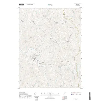
2019 Map of Grantsville
USGS Topo · Published 2019About this map
The Little Kanawha River carves a deep, winding path through Calhoun County, anchoring the town of Grantsville. This 2019 survey documents the river-oriented geography of the region, where infrastructure like the Bernard P Bell Bridge and Little Kanawha River Bridge connect the community's core. The landscape is defined by its numerous small hollows and ridges, with high points such as Cabbage Knob and Hog Knob overlooking narrow valleys drained by Yellow Creek and Bull River.
Find a feature on this map
113 named features on this map. Tap any name to fly to it.
Don’t see what you’re looking for? This feature index may not catch every label — zoom into the map to look around manually.
Map Details
Editions of this 2019 Grantsville Map
This is the sole edition of this map. No revisions or reprints were ever made.
Other maps of this area

1893 · Sutton
USGS Topo · 1:125,000

1906 · Holbrook
USGS Topo · 1:62,500

1906 · Glenville
USGS Topo · 1:62,500

1907 · Harrisville
USGS Topo · 1:62,500

1907 · Arnoldsburg
USGS Topo · 1:62,500

1924 · Harrisville
USGS Topo · 1:62,500

1924 · Holbrook
USGS Topo · 1:62,500

1925 · Glenville
USGS Topo · 1:62,500

1925 · Arnoldsburg
USGS Topo · 1:62,500

1926 · Harrisville
USGS Topo · 1:62,500