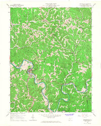
1966 Map of Grantsville
USGS Topo · Published 1967About this map
The Little Kanawha River meanders sharply through the center of this 1960s survey, creating a serpentine landscape where the county seat of Grantsville sits perched on a tight bend. This river-dominated geography is characterized by numerous tributary runs and forks, including Yellow Creek and Philip Run, which carve through the high ridges of Center and Sherman districts. The map documents an economy rooted in energy and regional services, evidenced by the proliferation of oil and gas wells across the hillsides, the industrial presence of Cabot Station, and the County Hospital serving the local population.
Find a feature on this map
51 named features on this map. Tap any name to fly to it.
Don’t see what you’re looking for? This feature index may not catch every label — zoom into the map to look around manually.
Map Details
Editions of this 1966 Grantsville Map
This is the sole edition of this map. No revisions or reprints were ever made.
Other maps of this area

1893 · Sutton
USGS Topo · 1:125,000

1906 · Holbrook
USGS Topo · 1:62,500

1906 · Glenville
USGS Topo · 1:62,500

1907 · Harrisville
USGS Topo · 1:62,500

1907 · Arnoldsburg
USGS Topo · 1:62,500

1924 · Harrisville
USGS Topo · 1:62,500

1924 · Holbrook
USGS Topo · 1:62,500

1925 · Glenville
USGS Topo · 1:62,500

1925 · Arnoldsburg
USGS Topo · 1:62,500

1926 · Harrisville
USGS Topo · 1:62,500