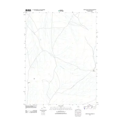
2012 Map of Grass Valley Wash
USGS Topo · Published 2012About this map
Grass Valley Wash dominates this high-desert drainage basin in White Pine County, where a network of ephemeral streams carves through a landscape defined by alluvial fans and stark elevation changes. The hydrology is centered on Grass Valley Creek, which flows southeast toward the mouth of Grass Valley Canyon. Access through this isolated section of Nevada is primarily provided by Grass Valley Canyon Rd, a route that follows the natural contours of the valley floor. To the west, the Red Hills rise sharply from the basin, providing a distinct geological boundary marked by the Red Hills Pass. This survey illustrates the sparse infrastructure and rugged drainage patterns characteristic of the eastern Great Basin in the early twenty-first century.
Find a feature on this map
6 named features on this map. Tap any name to fly to it.
Don’t see what you’re looking for? This feature index may not catch every label — zoom into the map to look around manually.
Map Details
Editions of this 2012 Grass Valley Wash Map
This is the sole edition of this map. No revisions or reprints were ever made.
Other maps of this area

1956 · Ely
USGS Topo · 1:250,000

1959 · Ely
USGS Topo · 1:250,000

1963 · Ely
USGS Topo · 1:250,000
1981 · Tippett Canyon
USGS Topo · 1:24,000
1986 · Big Hard Pan
USGS Topo · 1:24,000
1986 · Tippett Pass
USGS Topo · 1:24,000
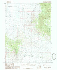
1986 · Grass Valley Wash
USGS Topo · 1:24,000
1986 · White Cloud Point
USGS Topo · 1:24,000
1986 · Rock Springs Pass
USGS Topo · 1:24,000
1986 · Government Peak
USGS Topo · 1:24,000