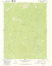
1979 Map of Grasshopper Ridge
USGS Topo · Published 1979About this map
Georges Ranch and several historical sites dot the steep drainages of the Klamath National Forest in this late 1970s topographic study. The landscape is defined by the deep carving of the South Fork Salmon River and its numerous tributaries, including Eddy Gulch and Shadow Creek. Evidence of the region's extractive history is visible near Sixmile Creek, where Dredge Tailings remain along the water's edge, and unidentified Mines are marked near Dry Gulch.
Find a feature on this map
39 named features on this map. Tap any name to fly to it.
Don’t see what you’re looking for? This feature index may not catch every label — zoom into the map to look around manually.
Map Details
Editions of this 1979 Grasshopper Ridge Map
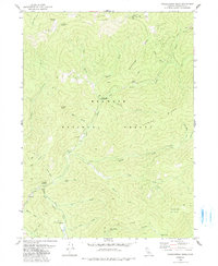
2 editions found
Other maps of this area

1886 · Shasta
USGS Topo · 1:250,000

1894 · Shasta
USGS Topo · 1:250,000

1923 · Sawyers Bar
USGS Topo · 1:125,000

1931 · Etna
USGS Topo · 1:96,000

1934 · Etna
USGS Topo · 1:125,000

1948 · Weed
USGS Topo · 1:250,000

1950 · Weed
USGS Topo · 1:250,000

1955 · Cecilville
USGS Topo · 1:62,500

1955 · Sawyers Bar
USGS Topo · 1:62,500

1955 · Etna
USGS Topo · 1:62,500