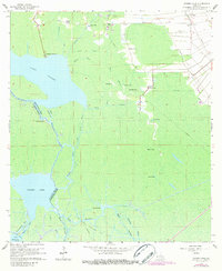
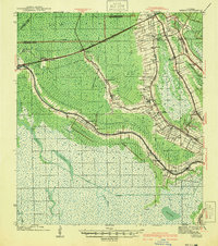
1965 Map of Grassy Lake
USGS Topo · Published 1984About this map
Lake Verret and Grassy Lake dominate this mid-century Louisiana landscape, where the intricate hydrology of Assumption Parish meets the industrial infrastructure of the 1960s. The map illustrates a network of waterways including Fourmile Bayou, Bayou Geneve, and the Himalaya Canal, which served as vital corridors through the cypress-laden basin. Small settlements and landings like Attakapas Landing, Upper Texas, and Flower Texas are linked by a mix of unimproved dirt roads and the Landside Route. Evidence of the region's energy and agricultural economy is clear, from the Southern Pacific tracks near Oakley to scattered gas wells and the Dwight Fields. The parish line between Assumption and St. Martin follows the winding course of the bayous, reflecting how the shifting water governed the political and social boundaries of the era.
Find a feature on this map
43 named features on this map. Tap any name to fly to it.
Don’t see what you’re looking for? This feature index may not catch every label — zoom into the map to look around manually.
Map Details
Editions of this 1965 Grassy Lake Map
4 editions found
Other maps of this area

1892 · Gibson
USGS Topo · 1:62,500

1892 · Thibodaux
USGS Topo · 1:62,500

1897 · Gibson
USGS Topo · 1:62,500

1927 · Thibodaux NW
USGS Topo · 1:31,680

1932 · Thibodaux SW
USGS Topo · 1:31,680

1935 · Morgan City
USGS Topo · 1:62,500

1938 · Labadieville
USGS Topo · 1:24,000

1939 · Gibson
USGS Topo · 1:62,500

1940 · Madewood
USGS Topo · 1:31,680
1941 · Gibson
USGS Topo · 1:62,500