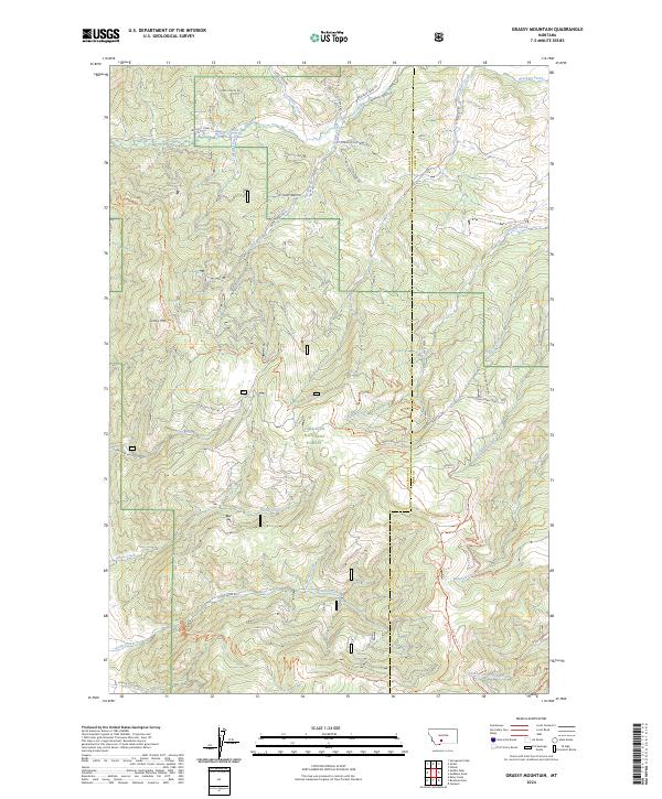
2024 Map of Grassy Mountain
USGS Topo · Published 2024About this map
Gallatin National Forest dominates this landscape along the border of Gallatin and Park counties. The terrain is defined by the high point of Grassy Mtn and a complex drainage network that includes Brackett Creek to the north and Stone Creek to the south. A dense system of forestry and access roads like Skunk Creek Rd and Olsen Creek Rd indicates the area's ongoing management and recreational importance. Modern infrastructure is represented by the Bangtail Divide Trl, which traverses the high ridges, while older routes such as School Gulch Rd hint at the historical navigation of these steep drainages. The map provides a clear look at the intersection of public land boundaries and the natural watercourses that have historically shaped this part of the Montana interior.
Find a feature on this map
43 named features on this map. Tap any name to fly to it.
Don’t see what you’re looking for? This feature index may not catch every label — zoom into the map to look around manually.
Map Details
Editions of this 2024 Grassy Mountain Map
This is the sole edition of this map. No revisions or reprints were ever made.
Other maps of this area

1891 · Livingston
USGS Topo · 1:250,000

1893 · Livingston
USGS Topo · 1:250,000

1947 · Bozeman
USGS Topo · 1:250,000

1948 · Bozeman
USGS Topo · 1:250,000

1951 · Bozeman Pass
USGS Topo · 1:62,500

1951 · Gobblers Knob
USGS Topo · 1:24,000

1951 · Hoppers
USGS Topo · 1:24,000
1951 · Wilsall
USGS Topo · 1:24,000

1951 · Sedan
USGS Topo · 1:62,500

1955 · Bozeman
USGS Topo · 1:250,000