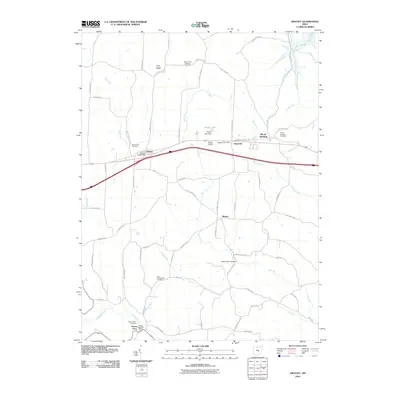
2010 Map of Gratiot
USGS Topo · Published 2010About this map
Gratiot and Hopewell serve as the primary hubs along the historic east-west corridor of Hopewell National Rd in this 2010 survey of Muskingum and Perry Counties. The landscape is defined by the prominent Flint Ridge to the north and a network of waterways including Kent Run, Thompson Run, and Jonathan Creek. This area maintains a strong connection to its 19th-century roots through its numerous burial grounds, such as the Old Presbyterian Cemetery and Mount Olive Lutheran Cemetery, which offer valuable data for genealogists tracing early families. The rural character is punctuated by small community centers like Wesley and Mount Perry, while Porter Lake and its accompanying Porter Lake Dam provide a focal point for local water management and recreation near the private Porter Airport.
Find a feature on this map
69 named features on this map. Tap any name to fly to it.
Don’t see what you’re looking for? This feature index may not catch every label — zoom into the map to look around manually.
Map Details
Editions of this 2010 Gratiot Map
This is the sole edition of this map. No revisions or reprints were ever made.
Other maps of this area

1909 · Newark
USGS Topo · 1:62,500

1909 · Thornville
USGS Topo · 1:62,500

1910 · Frazeysburg
USGS Topo · 1:62,500

1910 · Zanesville
USGS Topo · 1:62,500

1947 · Columbus
USGS Topo · 1:250,000

1950 · Marion
USGS Topo · 1:250,000

1961 · Columbus
USGS Topo · 1:250,000

1961 · Hanover
USGS Topo · 1:24,000

1961 · Zanesville West
USGS Topo · 1:24,000
1961 · Fultonham
USGS Topo · 1:24,000