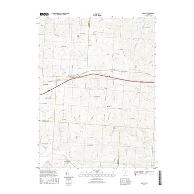
2016 Map of Gratiot
USGS Topo · Published 2016About this map
Flint Ridge and the surrounding hill country of the Ohio interior are documented here at a convergence of Licking, Muskingum, and Perry Counties. The landscape is defined by the high ground of the t1n r10w and t1n r9w survey townships, where small settlements like Gratiot and Hopewell align along the historic corridor of the National Rd SE and W Pike. This transit route remains a primary axis of development, punctuated by local landmarks like Porter Airport and the bridge at Jacks Hollow.
Find a feature on this map
98 named features on this map. Tap any name to fly to it.
Don’t see what you’re looking for? This feature index may not catch every label — zoom into the map to look around manually.
Map Details
Editions of this 2016 Gratiot Map
This is the sole edition of this map. No revisions or reprints were ever made.
Other maps of this area

1909 · Newark
USGS Topo · 1:62,500

1909 · Thornville
USGS Topo · 1:62,500

1910 · Frazeysburg
USGS Topo · 1:62,500

1910 · Zanesville
USGS Topo · 1:62,500

1947 · Columbus
USGS Topo · 1:250,000

1950 · Marion
USGS Topo · 1:250,000

1961 · Columbus
USGS Topo · 1:250,000

1961 · Hanover
USGS Topo · 1:24,000

1961 · Zanesville West
USGS Topo · 1:24,000
1961 · Fultonham
USGS Topo · 1:24,000