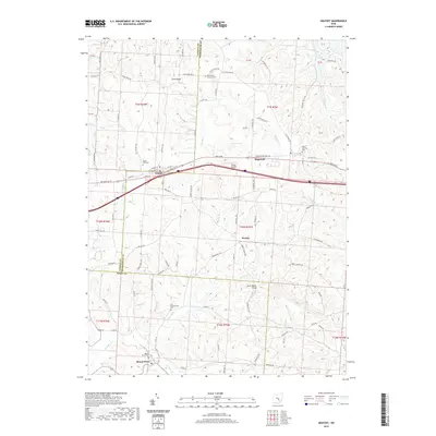
2019 Map of Gratiot
USGS Topo · Published 2019About this map
Gratiot sits at the intersection of the county lines for Licking and Muskingum, serving as a primary settlement point in this rural landscape. The terrain is defined by the winding course of Kent Run and its tributaries, including Thompson Run and Painter Run, which carve through the hills of East-Central Ohio. This 2019 survey documents a region where transportation infrastructure like Porter Airport and the Hopewell National Rd overlays a much older pattern of small communities and family burial grounds. Notable local history landmarks include Mount Perry at the southern edge and the quiet settlement of Wesley. Several established cemeteries, such as the Old Presbyterian Cem and Poplar Fork Cem, are clearly marked, providing essential data for genealogists tracking long-established residents in the townships of Hopewell and Madison. The map also captures the local drainage patterns around Porter Lake and the structural crossing at Jacks Hollow Bridge.
Find a feature on this map
97 named features on this map. Tap any name to fly to it.
Don’t see what you’re looking for? This feature index may not catch every label — zoom into the map to look around manually.
Map Details
Editions of this 2019 Gratiot Map
This is the sole edition of this map. No revisions or reprints were ever made.
Other maps of this area

1909 · Newark
USGS Topo · 1:62,500

1909 · Thornville
USGS Topo · 1:62,500

1910 · Frazeysburg
USGS Topo · 1:62,500

1910 · Zanesville
USGS Topo · 1:62,500

1947 · Columbus
USGS Topo · 1:250,000

1950 · Marion
USGS Topo · 1:250,000

1961 · Columbus
USGS Topo · 1:250,000

1961 · Hanover
USGS Topo · 1:24,000

1961 · Zanesville West
USGS Topo · 1:24,000
1961 · Fultonham
USGS Topo · 1:24,000