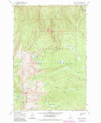
1966 Map of Grave Peak
USGS Topo · Published 1984About this map
Grave Peak stands as the prominent landmark of this high-elevation wilderness, where the boundaries of the Clearwater National Forest and the Selway-Bitterroot Wilderness meet. The landscape is defined by a series of high ridges and deep drainages, including Friday Ridge and the Cliff formation. The 1966 survey, later updated in 1984, documents a network of high-country pack trails such as the Pack Trail and White Sand Creek Trail, which provided the primary access to this backcountry long before modernized infrastructure reached the interior. Numerous alpine basins are home to features like the Walton Lakes, Colt Lake, and Wind Lakes. Broad valley floor openings, specifically Sneakfoot Meadows and Kooskooskia Meadows, provide critical riparian habitat and transit points along Walton Creek and Colt Creek. The map serves as a detailed record of the era's land management and primitive trail systems.
Find a feature on this map
33 named features on this map. Tap any name to fly to it.
Don’t see what you’re looking for? This feature index may not catch every label — zoom into the map to look around manually.
Map Details
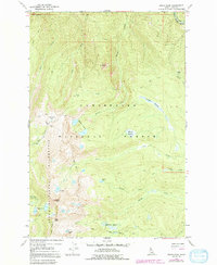
Editions of this 1966 Grave Peak Map
3 editions found
Other maps of this area

1911 · Lolo
USGS Topo · 1:250,000

1913 · Lolo
USGS Topo · 1:250,000

1956 · Hamilton
USGS Topo · 1:250,000

1959 · Hamilton
USGS Topo · 1:250,000

1960 · Hamilton
USGS Topo · 1:250,000

1964 · Hamilton
USGS Topo · 1:250,000

1964 · Rocky Point
USGS Topo · 1:24,000

1964 · Roundtop
USGS Topo · 1:24,000

1966 · Grave Peak
USGS Topo · 1:24,000
1966 · Hungry Rock
USGS Topo · 1:24,000