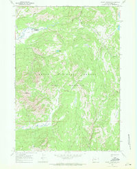
1965 Map of Gravel Mountain
USGS Topo · Published 1971About this map
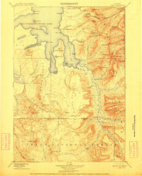
Teton National Forest and the surrounding wilderness are documented here in the mid-1960s, prior to later shifts in management and conservation. The landscape is defined by the high elevations of Gravel Mountain and Mount Randolph, which tower over a complex network of drainages including the headwaters of Pacific Creek and Lava Creek. The survey focuses on the primitive backcountry infrastructure of the Teton Wilderness, illustrating a region accessible primarily by foot or horseback. Systematic trail networks such as the Pacific Creek Trail and Enos Creek Trail connect remote water bodies like Enos Lake and Moss Lake. The lack of any established road names or structures on this sheet underscores the isolation of Gravel Ridge, making it a primary resource for tracing the historical paths of backcountry travelers through this corner of Wyoming.
Find a feature on this map
17 named features on this map. Tap any name to fly to it.
Don’t see what you’re looking for? This feature index may not catch every label — zoom into the map to look around manually.
Map Details
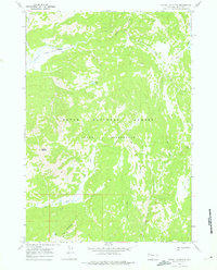
Editions of this 1965 Gravel Mountain Map
2 editions found
Other maps of this area

1885 · Lake
USGS Topo · 1:125,000

1895 · Lake
USGS Topo · 1:125,000

1896 · Lake
USGS Topo · 1:125,000

1901 · Lake
USGS Topo · 1:125,000
1902 · Mt Leidy
USGS Topo · 1:125,000
1906 · Lake
USGS Topo · 1:125,000
1911 · Lake
USGS Topo · 1:125,000

1955 · Ashton
USGS Topo · 1:250,000

1955 · Driggs
USGS Topo · 1:250,000

1958 · Driggs
USGS Topo · 1:250,000