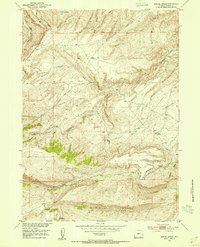
1953 Map of Gravel Spring
USGS Topo · Published 1954About this map
Gustin Homestead and Chapman Homestead stand as markers of early 20th-century settlement within this drainage-rich portion of Fremont County. Established as part of the Missouri River Basin development program, this survey details the complex hydraulic landscape of the area, where the Tweed Ditch diverts water across a terrain defined by the Red Canyon Rim and Commissary Hill. The topography is a network of named drainages, including the West Fork Cottonwood Creek and Stambaugh Creek, which feed into larger systems like Beaver Creek. The presence of several distinct water sources, such as Gravel Spring and Dilabaugh Spring, suggests the critical importance of reliable water for both livestock and the few homesteaders established in these high drainages. Several trails and routes are marked as (ABANDONED), indicating a shifting pattern of movement and land use during the mid-century era.
Find a feature on this map
22 named features on this map. Tap any name to fly to it.
Don’t see what you’re looking for? This feature index may not catch every label — zoom into the map to look around manually.
Map Details
Editions of this 1953 Gravel Spring Map
2 editions found
Other maps of this area

1953 · Lewiston Lakes
USGS Topo · 1:24,000

1953 · Gravel Spring
USGS Topo · 1:24,000

1953 · Radium Springs
USGS Topo · 1:24,000

1953 · Schlichting Mountain
USGS Topo · 1:24,000

1953 · Del Monte Ridge
USGS Topo · 1:24,000

1953 · Atlantic City
USGS Topo · 1:24,000

1953 · Weiser Pass
USGS Topo · 1:24,000

1954 · Wolf Point
USGS Topo · 1:24,000

1954 · Miners Delight
USGS Topo · 1:24,000

1955 · Lander
USGS Topo · 1:250,000