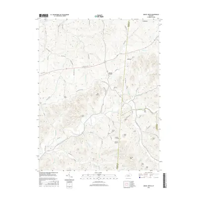
2016 Map of Gravel Switch
USGS Topo · Published 2016About this map
The Beech Fork and North Rolling Fork river systems define the geography of this central Kentucky landscape, where the communities of Gravel Switch, Aliceton, and Riley serve as historic anchor points. The map reveals a high concentration of family-named knobs and high points, such as Cooley Knob, Buffalo Lick Knob, and Porter Knob, reflecting the complex topography of the region. Local heritage is deeply embedded in the numerous burial sites scattered across the ridges, including Rollertown Cem, Crews Cem, and Elder Cem. A notable geographic landmark, Lovers Leap, overlooks the winding path of the North Rolling Fork, while smaller settlements like Craintown sit along the northern edge of the survey. The intricate network of rural routes, such as Beech Fork Church Rd and Riley-Gravel Switch Rd, provides a clear view of the traditional connection between these upland settlements and their water sources.
Find a feature on this map
92 named features on this map. Tap any name to fly to it.
Don’t see what you’re looking for? This feature index may not catch every label — zoom into the map to look around manually.
Map Details
Editions of this 2016 Gravel Switch Map
This is the sole edition of this map. No revisions or reprints were ever made.
Other maps of this area

1905 · Harrodsburg
USGS Topo · 1:125,000

1952 · Perryville
USGS Topo · 1:24,000

1952 · Ellisburg
USGS Topo · 1:24,000

1952 · Bradfordsville
USGS Topo · 1:24,000

1952 · Parksville
USGS Topo · 1:24,000

1953 · Mackville
USGS Topo · 1:24,000

1953 · Bradfordsville NE
USGS Topo · 1:24,000

1953 · Gravel Switch
USGS Topo · 1:24,000

1953 · Lebanon East
USGS Topo · 1:24,000

1953 · Springfield
USGS Topo · 1:24,000