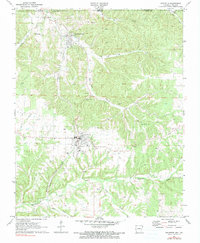
1971 Map of Gravette
USGS Topo · Published 1990About this map
Gravette sits at the junction of rail and road in the northwest corner of Arkansas, captured here just after the turn of the 1970s. The Kansas City Southern railroad serves as the primary spine for the region, cutting south through Sulphur Springs and following the contours of Rocky Dell Hollow. This landscape is defined by its subterranean and surface features, from the curiosity of Spanish Treasure Cave and Popcorn Cave to the prominent rise of Roundtop. Numerous watercourses including Elk River, Butler Creek, and Spavinaw Creek drain the undulating terrain. Local heritage is preserved in several burial grounds such as Bethel Cem and GAR Cem, while the presence of several Quarries and a Hospital in Gravette indicates the industrial and civic infrastructure of the era.
Find a feature on this map
28 named features on this map. Tap any name to fly to it.
Don’t see what you’re looking for? This feature index may not catch every label — zoom into the map to look around manually.
Map Details
Editions of this 1971 Gravette Map
2 editions found
Other maps of this area

1899 · Fayetteville
USGS Topo · 1:125,000

1899 · Siloam Springs
USGS Topo · 1:125,000

1901 · Fayetteville
USGS Topo · 1:125,000

1903 · Siloam Springs
USGS Topo · 1:125,000

1904 · Siloam Springs
USGS Topo · 1:125,000

1904 · Fayetteville
USGS Topo · 1:125,000

1907 · Wyandotte
USGS Topo · 1:125,000

1909 · Wyandotte
USGS Topo · 1:125,000

1940 · Noel
USGS Topo · 1:62,500

1943 · Noel
USGS Topo · 1:62,500