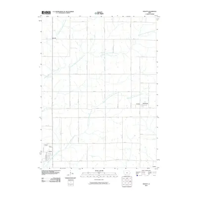
2010 Map of Gravity
USGS Topo · Published 2010About this map
Gravity anchors this Taylor County agricultural landscape, where the town's namesake cemetery and Washington Cemetery provide essential focal points for family history research. The area is defined by the complex hydrology of the One Hundred and Two River, which splits into the West Branch, Middle Branch, and Middle Fork. These waterways cut through a strict grid of section roads, including 120th St and 200th St, which organize the rural farmstead distribution. Smaller hamlets like Bushville, Conway, and Sharpsburg are scattered throughout the quadrangle, with the Sharpsburg Post Office serving as a central community landmark. The map documents the enduring rural character of Southwest Iowa, showing the relationship between small-town centers and the surrounding drainage basins.
Find a feature on this map
22 named features on this map. Tap any name to fly to it.
Don’t see what you’re looking for? This feature index may not catch every label — zoom into the map to look around manually.
Map Details
Editions of this 2010 Gravity Map
This is the sole edition of this map. No revisions or reprints were ever made.
Other maps of this area

1940 · Bedford
USGS Topo · 1:62,500

1940 · New Market
USGS Topo · 1:62,500

1943 · Bedford
USGS Topo · 1:62,500

1943 · New Market
USGS Topo · 1:62,500

1955 · Nebraska City
USGS Topo · 1:250,000

1957 · Nebraska City
USGS Topo · 1:250,000

1958 · Nebraska City
USGS Topo · 1:250,000

1980 · Corning South
USGS Topo · 1:24,000

1980 · Gravity
USGS Topo · 1:24,000

1980 · Merle Junction
USGS Topo · 1:24,000