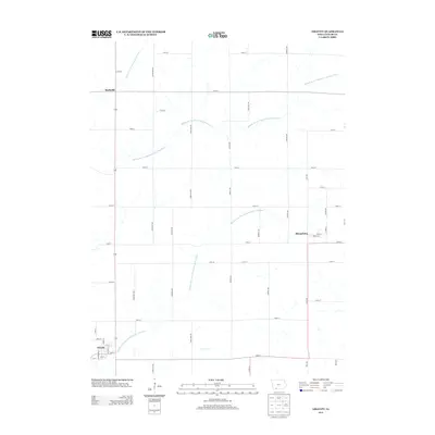
2013 Map of Gravity
USGS Topo · Published 2013About this map
Gravity occupies the southwestern corner of this agricultural landscape in Taylor County, defined by the intricate drainage of the Middle Fork One Hundred and Two River. The terrain is marked by a precise grid of rural corridors, including Maryland Ave and Naples Ave, which link small clusters of habitation across the countryside. The northeastern portion of the sheet features the settlement of Sharpsburg, where local life centers around Main St and Front St. Further north, the crossroads at Bushville sits near the headwaters of the W Br One Hundred and Two River. This 2013 survey illustrates the enduring patterns of Iowa's rural township structure, where the watercourses and section roads dictate the placement of every farmstead and village center.
Find a feature on this map
43 named features on this map. Tap any name to fly to it.
Don’t see what you’re looking for? This feature index may not catch every label — zoom into the map to look around manually.
Map Details
Editions of this 2013 Gravity Map
This is the sole edition of this map. No revisions or reprints were ever made.
Other maps of this area
1940 · Bedford
USGS Topo · 1:62,500
1940 · New Market
USGS Topo · 1:62,500
1943 · Bedford
USGS Topo · 1:62,500
1943 · New Market
USGS Topo · 1:62,500
1955 · Nebraska City
USGS Topo · 1:250,000
1957 · Nebraska City
USGS Topo · 1:250,000
1958 · Nebraska City
USGS Topo · 1:250,000
1980 · Corning South
USGS Topo · 1:24,000
1980 · Gravity
USGS Topo · 1:24,000
1980 · Merle Junction
USGS Topo · 1:24,000