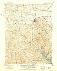
1904 Map of Gravois Mills
USGS Topo · Published 1950About this map
Versailles serves as a central hub in this Ozark landscape, where early 20th-century industry and topography meet. The map reveals a transition in transportation as the Chicago Rock Island and Pacific railroad crosses the northern half, while a portion of the Missouri Pacific R. R. is already marked as abandoned. The southern terrain is dominated by the rising waters of the Lake of the Ozarks, a major modification to the drainage of Gravois Mills and its surrounding creeks like Soap Creek and Indian Creek.
Find a feature on this map
39 named features on this map. Tap any name to fly to it.
Don’t see what you’re looking for? This feature index may not catch every label — zoom into the map to look around manually.
Map Details
Editions of this 1904 Gravois Mills Map
2 editions found
Other maps of this area

1887 · Sedalia
USGS Topo · 1:125,000

1887 · Warsaw
USGS Topo · 1:125,000

1888 · Versailles
USGS Topo · 1:125,000

1888 · Boonville
USGS Topo · 1:125,000

1893 · Versailles
USGS Topo · 1:125,000

1894 · Warsaw
USGS Topo · 1:125,000

1894 · Sedalia
USGS Topo · 1:125,000

1904 · Eldon
USGS Topo · 1:62,500

1904 · Gravois Mills
USGS Topo · 1:62,500

1932 · Versailles No 4
USGS Topo · 1:48,000