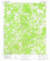
1974 Map of Grays Chapel
USGS Topo · Published 1977About this map
Southern railroad tracks carve a north-south path through this part of Randolph County, linking small rural communities like Lineberry and Grays Chapel. The landscape is defined by the winding course of Sandy Creek and its tributaries, which eventually give way to the Deep River corridor at the southern edge. Here, the riverside settlements of Franklinville and Cedar Falls represent centers of local activity, situated near the banks of the river that historically powered the region's early development.
Find a feature on this map
28 named features on this map. Tap any name to fly to it.
Don’t see what you’re looking for? This feature index may not catch every label — zoom into the map to look around manually.
Map Details
Editions of this 1974 Grays Chapel Map
This is the sole edition of this map. No revisions or reprints were ever made.
Other maps of this area

1953 · Raleigh
USGS Topo · 1:250,000

1954 · Raleigh
USGS Topo · 1:250,000

1957 · Asheboro
USGS Topo · 1:62,500

1968 · Ramseur
USGS Topo · 1:24,000

1968 · Coleridge
USGS Topo · 1:24,000

1970 · Kimesville
USGS Topo · 1:24,000
1970 · Pleasant Garden
USGS Topo · 1:24,000
1970 · Climax
USGS Topo · 1:24,000

1970 · Randleman
USGS Topo · 1:24,000

1970 · Asheboro
USGS Topo · 1:24,000