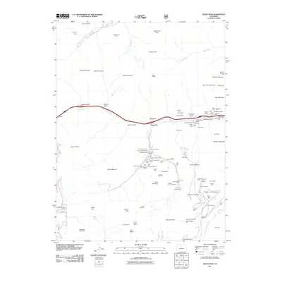
2011 Map of Grays Peak
USGS Topo · Published 2011About this map
Graymont and Bakerville sit along the upper reaches of Clear Creek, marking the high-altitude industrial and travel corridors of the Front Range in the early 21st century. The map provides an exceptionally detailed record of historical mining activity through the labeling of dozens of specific shafts and tunnels, including the Celestine Mine, Silver Wind One Mine, and the Golden Belt Mine complex near Stevens Gulch. This concentration of subterranean workings reflects over a century of extraction that shaped the local geography. Beyond the industrial remnants, the landscape is dominated by some of the state's highest summits, such as Grays Peak and Torreys Peak, connected by high-altitude trails and passes like Argentine Pass. At the western edge, the Arapaho Basin Ski Area indicates the region's modern transition to recreation, while the remote settlement of Waldorf remains as a marker of high-country history along Leavenworth Creek.
Find a feature on this map
107 named features on this map. Tap any name to fly to it.
Don’t see what you’re looking for? This feature index may not catch every label — zoom into the map to look around manually.
Map Details
Editions of this 2011 Grays Peak Map
This is the sole edition of this map. No revisions or reprints were ever made.
Other maps of this area

1903 · Georgetown
USGS Topo · 1:62,500

1905 · Central City
USGS Topo · 1:62,500

1905 · Georgetown
USGS Topo · 1:62,500

1910 · Central City
USGS Topo · 1:62,500

1912 · Central City
USGS Topo · 1:62,500

1924 · Montezuma
USGS Topo · 1:62,500

1924 · Fraser
USGS Topo · 1:62,500

1926 · Fraser
USGS Topo · 1:62,500

1926 · Montezuma
USGS Topo · 1:62,500

1933 · Montezuma
USGS Topo · 1:62,500