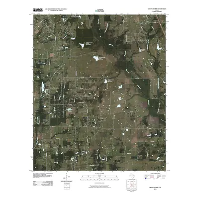
2010 Map of Grays Prairie
USGS Topo · Published 2010About this map
Grays Prairie serves as the primary community anchor in this part of Kaufman County, situated at the intersection of several farm-to-market roads. The landscape is defined by an extensive water management network, featuring multiple soil conservation dams and reservoirs like Coffee Lake and Vaughn Lake. These structures, identified by their specific site numbers such as Soil Conservation Service Site 70, indicate a period of significant drainage and land-use engineering designed to stabilize the local prairie terrain. Smaller rural settlements such as Lively and Stubbs appear along the south, connected by FM 148. The drainage pattern is driven by Kings Creek and Caney Creek, which flow through a region characterized by family-named landmarks like Wells Dam and the aviation strip at Erco Field.
Find a feature on this map
69 named features on this map. Tap any name to fly to it.
Don’t see what you’re looking for? This feature index may not catch every label — zoom into the map to look around manually.
Map Details
Editions of this 2010 Grays Prairie Map
This is the sole edition of this map. No revisions or reprints were ever made.
Other maps of this area

1920 · Kemp
USGS Topo · 1:62,500

1954 · Dallas
USGS Topo · 1:250,000

1956 · Kaufman
USGS Topo · 1:62,500

1957 · Kemp
USGS Topo · 1:62,500

1958 · Dallas
USGS Topo · 1:250,000

1960 · Tool
USGS Topo · 1:24,000

1960 · Grays Prairie
USGS Topo · 1:24,000

1961 · Kemp
USGS Topo · 1:24,000

1962 · Rosser SW
USGS Topo · 1:24,000
1962 · Styx
USGS Topo · 1:24,000