
1961 Map of Kemp
USGS Topo · Published 1962About this map
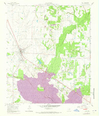
The town of Kemp stands as the primary hub of activity in this 1961 survey, situated at the junction of the Southern Pacific and Texas and New Orleans railroads. The landscape is defined by the drainage basins of Cedar Creek, Kings Creek, and the Lacy Fork, showing a rural Texas economy transitioning into the 1960s. Local infrastructure is prominently mapped, including a Stadium and Water Tank in Kemp, while the surrounding countryside features small settlements like Becker and Gossett. Industrial footprints are visible through several Oil Wells, a Gravel Pit, and various Sludge Pit labels, alongside a significant Pipeline corridor. The northeastern portion of the map is dominated by the Tarrent County Water Control and Improvement District No. 1, signaling the area's ongoing hydrological management and utility development during this era.
Find a feature on this map
23 named features on this map. Tap any name to fly to it.
Don’t see what you’re looking for? This feature index may not catch every label — zoom into the map to look around manually.
Map Details
Editions of this 1961 Kemp Map
4 editions found
Other maps of this area

1920 · Kemp
USGS Topo · 1:62,500

1954 · Dallas
USGS Topo · 1:250,000

1956 · Kaufman
USGS Topo · 1:62,500

1957 · Kemp
USGS Topo · 1:62,500

1958 · Dallas
USGS Topo · 1:250,000

1960 · Tool
USGS Topo · 1:24,000

1960 · Mabank
USGS Topo · 1:24,000

1960 · Grays Prairie
USGS Topo · 1:24,000

1962 · Prairieville
USGS Topo · 1:24,000

1962 · Cedarvale
USGS Topo · 1:24,000