
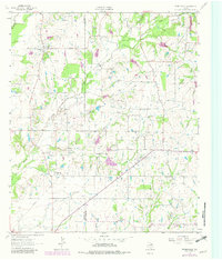
1962 Map of Prairieville
USGS Topo · Published 1965About this map
Prairieville stands as a focal point in this 1962 topography, situated near the western edge of Van Zandt County at the boundary with Kaufman County. The landscape is defined by the dendritic drainage patterns of the Lacy Fork and Cedar Creek, where small farm ponds and drainage ditches cut through the undulating terrain. Rural life is anchored by small community landmarks such as the Fourmile Ch, Elm Grove Ch, and the White-Hall Community Center.
Find a feature on this map
18 named features on this map. Tap any name to fly to it.
Don’t see what you’re looking for? This feature index may not catch every label — zoom into the map to look around manually.
Map Details
Editions of this 1962 Prairieville Map
2 editions found
Other maps of this area

1920 · Kemp
USGS Topo · 1:62,500

1948 · Martins Mill
USGS Topo · 1:62,500

1949 · Martins Mill
USGS Topo · 1:62,500

1954 · Dallas
USGS Topo · 1:250,000

1956 · Tyler
USGS Topo · 1:250,000

1957 · Kemp
USGS Topo · 1:62,500

1958 · Dallas
USGS Topo · 1:250,000

1960 · Tool
USGS Topo · 1:24,000

1960 · Mabank
USGS Topo · 1:24,000

1961 · Kemp
USGS Topo · 1:24,000