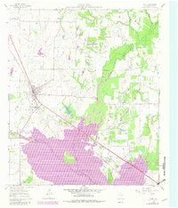
1961 Map of Kemp
USGS Topo · Published 1982About this map
Kemp and the smaller settlement of Becker are the primary hubs of activity in this Kaufman County landscape, which underwent significant transformation during the mid-20th century. The arrival of the Cedar Creek Reservoir dominates the southern portion of the map, illustrating the impact of the Tarrent County Water Control and Improvement District No. 1 on the local terrain.
Find a feature on this map
15 named features on this map. Tap any name to fly to it.
Don’t see what you’re looking for? This feature index may not catch every label — zoom into the map to look around manually.
Map Details
Editions of this 1961 Kemp Map
4 editions found
Other maps of this area

1920 · Kemp
USGS Topo · 1:62,500

1954 · Dallas
USGS Topo · 1:250,000

1956 · Kaufman
USGS Topo · 1:62,500

1957 · Kemp
USGS Topo · 1:62,500

1958 · Dallas
USGS Topo · 1:250,000

1960 · Tool
USGS Topo · 1:24,000

1960 · Mabank
USGS Topo · 1:24,000

1960 · Grays Prairie
USGS Topo · 1:24,000

1961 · Kemp
USGS Topo · 1:24,000

1962 · Prairieville
USGS Topo · 1:24,000