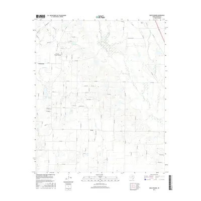
2016 Map of Grays Prairie
USGS Topo · Published 2016About this map
Grays Prairie and the neighboring settlements of Cottonwood and Lively define the rural character of this Kaufman County landscape. Situated at a transition of the North Texas prairies, the area is dissected by several significant waterways, including Kings Cr and the winding course of Bois d'Arc Cr. These creek systems, along with Little Cottonwood Cr and Caney Cr, have shaped the distribution of homes and farmsteads along the network of county roads and farm-to-market routes like FM 148 and FM 2451.
Find a feature on this map
87 named features on this map. Tap any name to fly to it.
Don’t see what you’re looking for? This feature index may not catch every label — zoom into the map to look around manually.
Map Details
Editions of this 2016 Grays Prairie Map
This is the sole edition of this map. No revisions or reprints were ever made.
Other maps of this area

1920 · Kemp
USGS Topo · 1:62,500

1954 · Dallas
USGS Topo · 1:250,000

1956 · Kaufman
USGS Topo · 1:62,500

1957 · Kemp
USGS Topo · 1:62,500

1958 · Dallas
USGS Topo · 1:250,000

1960 · Tool
USGS Topo · 1:24,000

1960 · Grays Prairie
USGS Topo · 1:24,000

1961 · Kemp
USGS Topo · 1:24,000

1962 · Rosser SW
USGS Topo · 1:24,000
1962 · Styx
USGS Topo · 1:24,000