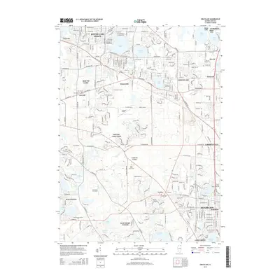
2015 Map of Grayslake
USGS Topo · Published 2015About this map
Grayslake and its surrounding glacial lake landscape serve as the center of this detailed 2015 study of northern Illinois. The suburban and semi-rural transition of Lake County is evident in the cluster of aviation history seen at Rockenbach Airport, Campbell Airport, and Air Estates Inc Airport, alongside the sprawling campus of the College of Lake County. The region's spiritual and educational legacy is anchored by the University of Saint Mary of the Lake and historic burial grounds like Saint Mary's Catholic Cemetery and Ivanhoe Cemetery.
Find a feature on this map
274 named features on this map. Tap any name to fly to it.
Don’t see what you’re looking for? This feature index may not catch every label — zoom into the map to look around manually.
Map Details
Editions of this 2015 Grayslake Map
This is the sole edition of this map. No revisions or reprints were ever made.
Other maps of this area

1900 · Highwood
USGS Topo · 1:62,500

1906 · Waukegan
USGS Topo · 1:62,500

1908 · Waukegan
USGS Topo · 1:62,500

1920 · Grays Lake
USGS Topo · 1:62,500

1923 · Grays Lake
USGS Topo · 1:62,500

1923 · Barrington
USGS Topo · 1:62,500

1928 · Wheeling
USGS Topo · 1:24,000

1935 · Barrington
USGS Topo · 1:62,500
1953 · Wheeling
USGS Topo · 1:24,000

1954 · Rockford
USGS Topo · 1:250,000