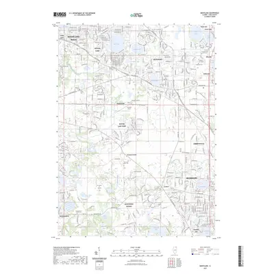
2023 Map of Grayslake
USGS Topo · Published 2023About this map
Grayslake and its surrounding glacial lake landscape are defined by a dense network of suburban developments and preserved water bodies. The transition from older crossroads like Fremont Center and Hainesville to modern residential corridors is evident, with significant institutional hubs such as the College of Lake County and the University Center of Lake County anchoring the eastern side. The map reveals a complex hydrography, where Grays Lake and Cranberry Lake sit nestled between established neighborhoods.
Find a feature on this map
97 named features on this map. Tap any name to fly to it.
Don’t see what you’re looking for? This feature index may not catch every label — zoom into the map to look around manually.
Map Details
Editions of this 2023 Grayslake Map
This is the sole edition of this map. No revisions or reprints were ever made.
Other maps of this area

1900 · Highwood
USGS Topo · 1:62,500

1906 · Waukegan
USGS Topo · 1:62,500

1908 · Waukegan
USGS Topo · 1:62,500

1920 · Grays Lake
USGS Topo · 1:62,500

1923 · Grays Lake
USGS Topo · 1:62,500

1923 · Barrington
USGS Topo · 1:62,500

1928 · Wheeling
USGS Topo · 1:24,000

1935 · Barrington
USGS Topo · 1:62,500
1953 · Wheeling
USGS Topo · 1:24,000

1954 · Rockford
USGS Topo · 1:250,000