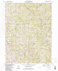
1994 Map of Graysville
USGS Topo · Published 1998About this map
Wayne National Forest land dominates this section of the Unglaciated Allegheny Plateau, where steep ridges and narrow hollows dictate the layout of rural Monroe County. The Little Muskingum River and its numerous tributaries, including Clear Fork and Broomstick Run, carve through the terrain, providing the low-ground routes for early settlements like Sycamore Valley. This map captures a landscape defined by small-scale resource extraction and community focal points, evidenced by numerous Gas Wells scattered across high ridges like Hintshon Ridge and Wolfpen Ridge. Significant local history sites are preserved here, from the Covered Bridge near the Hershey Cem to the Lamping Cem (Indian Mound) near Marr. These features, along with the Grange Hall and scattered country schools like Wayne Sch, reflect the enduring social and economic structures of these Appalachian foothills.
Find a feature on this map
70 named features on this map. Tap any name to fly to it.
Don’t see what you’re looking for? This feature index may not catch every label — zoom into the map to look around manually.
Map Details
Editions of this 1994 Graysville Map
This is the sole edition of this map. No revisions or reprints were ever made.
Other maps of this area

1903 · Macksburg
USGS Topo · 1:62,500

1905 · New Matamoras
USGS Topo · 1:62,500

1905 · Woodsfield
USGS Topo · 1:62,500

1905 · Macksburg
USGS Topo · 1:62,500

1909 · Summerfield
USGS Topo · 1:62,500

1911 · Summerfield
USGS Topo · 1:62,500

1924 · New Matamoras
USGS Topo · 1:62,500

1926 · New Matamoras
USGS Topo · 1:62,500

1949 · Clarksburg
USGS Topo · 1:250,000

1956 · Clarksburg
USGS Topo · 1:250,000