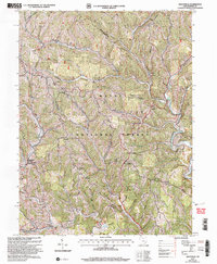
2002 Map of Graysville
USGS Topo · Published 2006About this map
Wayne National Forest blankets the ridgelines and hollows of Monroe County in this early 21st-century record of rural Ohio. The landscape is defined by its deep dissection, with numerous creek forks like Straight Fork and Clear Fork carving through family-named ridges such as Brister Ridge and Graham Ridge. Settlement is clustered around high-ground crossroads and narrow valley floors, evidenced by the scattered communities of Graysville, Sycamore Valley, and Marr.
Find a feature on this map
77 named features on this map. Tap any name to fly to it.
Don’t see what you’re looking for? This feature index may not catch every label — zoom into the map to look around manually.
Map Details
Editions of this 2002 Graysville Map
This is the sole edition of this map. No revisions or reprints were ever made.
Other maps of this area

1903 · Macksburg
USGS Topo · 1:62,500

1905 · New Matamoras
USGS Topo · 1:62,500

1905 · Woodsfield
USGS Topo · 1:62,500

1905 · Macksburg
USGS Topo · 1:62,500

1909 · Summerfield
USGS Topo · 1:62,500

1911 · Summerfield
USGS Topo · 1:62,500

1924 · New Matamoras
USGS Topo · 1:62,500

1926 · New Matamoras
USGS Topo · 1:62,500

1949 · Clarksburg
USGS Topo · 1:250,000

1956 · Clarksburg
USGS Topo · 1:250,000