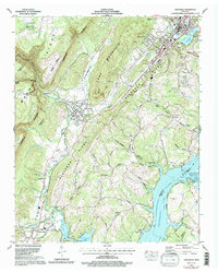
1972 Map of Graysville
USGS Topo · Published 1996About this map
Cranmore Cove and the dramatic rise of the Cumberland Escarpment define the geography of the Rhea County corridor in the early 1970s. The industrial and transportation backbone of the region follows the valley floor, where the Cincinnati New Orleans and Texas Pacific RR and U S Highway 27 connect settlements like Graysville and Sale Creek. The map documents a landscape of transition, from the higher Blackoak Ridge down to the eastern waters of Chickamauga Lake and the Tennessee River.
Find a feature on this map
78 named features on this map. Tap any name to fly to it.
Don’t see what you’re looking for? This feature index may not catch every label — zoom into the map to look around manually.
Map Details
Editions of this 1972 Graysville Map
4 editions found
Other maps of this area

1886 · Cleveland
USGS Topo · 1:125,000

1887 · Kingston
USGS Topo · 1:125,000

1888 · Chattanooga
USGS Topo · 1:125,000

1891 · Kingston
USGS Topo · 1:125,000

1892 · Pikeville
USGS Topo · 1:125,000

1892 · Cleveland
USGS Topo · 1:125,000

1893 · Chattanooga
USGS Topo · 1:125,000

1893 · Kingston
USGS Topo · 1:125,000

1895 · Cleveland
USGS Topo · 1:125,000

1895 · Pikeville
USGS Topo · 1:125,000