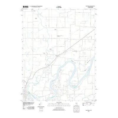
2010 Map of Grayville
USGS Topo · Published 2010About this map
The Wabash River carves a winding path through the borderlands of Illinois and Indiana, defining the landscape around Grayville. This survey illustrates the river's complex morphology, specifically the dramatic loops at Schuh Bend and Peankishaw Bend which create unique landforms like Pearl Island. The upland areas are largely defined by agricultural grid roads and scattered rural settlements such as Cowling and Browns. Genealogists will find a high density of burial grounds, including the Saint Johns Lutheran Church Cemetery and Freidens Cemetery, which point to the area's deep-rooted Lutheran heritage. The western portion of the map is drained by Bonpas Creek and Mud Creek, while Frazier Prairie remains a distinct topographical feature in the north. This document provides a record of the early 21st-century rural infrastructure, from the Denham Levee along the river to the network of county roads like Browns-Grayville Rd.
Find a feature on this map
33 named features on this map. Tap any name to fly to it.
Don’t see what you’re looking for? This feature index may not catch every label — zoom into the map to look around manually.
Map Details
Editions of this 2010 Grayville Map
This is the sole edition of this map. No revisions or reprints were ever made.
Other maps of this area

1903 · New Harmony
USGS Topo · 1:62,500

1903 · Patoka
USGS Topo · 1:125,000

1904 · Mount Carmel
USGS Topo · 1:62,500

1938 · New Harmony
USGS Topo · 1:62,500

1940 · Carmi
USGS Topo · 1:62,500

1943 · Carmi
USGS Topo · 1:62,500

1943 · Albion
USGS Topo · 1:62,500

1946 · Albion
USGS Topo · 1:62,500

1956 · Vincennes
USGS Topo · 1:250,000

1957 · Vincennes
USGS Topo · 1:250,000