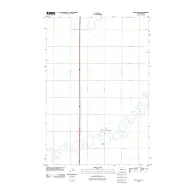
2011 Map of Great Bend
USGS Topo · Published 2011About this map
Great Bend sits at a pronounced oxbow of the Wild Rice River, illustrating the classic river-bend settlement pattern found throughout the Red River Valley. The terrain is characterized by the meandering waterway and its smaller tributary, South Branch Antelope Creek, which drains the northern sections of the quadrangle. This 2011 survey shows a landscape dominated by a precise section-line road grid, including County Rd 15 and County Rd 16, which support the region's agricultural layout. Local genealogy and history are anchored at the Trinity Cemetery, located just south of the main town site. The map captures the intersection of natural riparian hydrology and the rigid human geometry of North Dakota's farming country, centered around the eponymous bend in the river.
Find a feature on this map
19 named features on this map. Tap any name to fly to it.
Don’t see what you’re looking for? This feature index may not catch every label — zoom into the map to look around manually.
Map Details
Editions of this 2011 Great Bend Map
This is the sole edition of this map. No revisions or reprints were ever made.
Other maps of this area

1904 · Wahpeton
USGS Topo · 1:125,000

1953 · Fargo
USGS Topo · 1:250,000

1956 · Fargo
USGS Topo · 1:250,000

1960 · Mooreton West
USGS Topo · 1:24,000

1960 · Mooreton East
USGS Topo · 1:24,000

1964 · Hankinson
USGS Topo · 1:24,000

1964 · Fairmount NW
USGS Topo · 1:24,000

1964 · Mantador
USGS Topo · 1:24,000

1964 · Hankinson SE
USGS Topo · 1:24,000

1964 · Great Bend
USGS Topo · 1:24,000