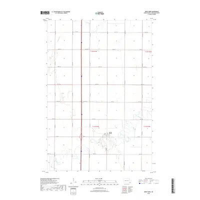
2018 Map of Great Bend
USGS Topo · Published 2018About this map
The settlement of Great Bend sits at a prominent bend in the Wild Rice River, serving as a central point in this part of Richland County. This 2018 survey illustrates a landscape deeply defined by the Public Land Survey System, with a precise grid of rural roads such as Co Rd 16 and 88th St SE carving through the agricultural terrain. The drainage patterns of the S Br Antelope Cr and the winding river define the remaining uncultivated areas, creating a sharp contrast between the geometric precision of the township boundaries and the fluid path of the water. For those researching local heritage, the Trinity Cem south of the main township remains a key landmark for genealogical study, while the overall road network provides a detailed layout of the modern rural infrastructure.
Find a feature on this map
23 named features on this map. Tap any name to fly to it.
Don’t see what you’re looking for? This feature index may not catch every label — zoom into the map to look around manually.
Map Details
Editions of this 2018 Great Bend Map
This is the sole edition of this map. No revisions or reprints were ever made.
Other maps of this area

1904 · Wahpeton
USGS Topo · 1:125,000

1953 · Fargo
USGS Topo · 1:250,000

1956 · Fargo
USGS Topo · 1:250,000

1960 · Mooreton West
USGS Topo · 1:24,000

1960 · Mooreton East
USGS Topo · 1:24,000

1964 · Hankinson
USGS Topo · 1:24,000

1964 · Fairmount NW
USGS Topo · 1:24,000

1964 · Mantador
USGS Topo · 1:24,000

1964 · Hankinson SE
USGS Topo · 1:24,000

1964 · Great Bend
USGS Topo · 1:24,000