
1954 Map of Great Falls
USGS Topo · Published 1954About this map
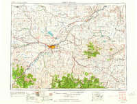
Great Falls serves as the industrial and transportation nexus for North-Central Montana in this mid-1950s survey. The city's growth is tied to the Missouri River, where the Anaconda Wire Plant and Rainbow Dam indicate the era's reliance on hydroelectric power and heavy industry. Military presence is prominent with the Great Falls Air Force Base located just east of the city, while Gore Hill Municipal Airport anchors the western plateau.
Find a feature on this map
151 named features on this map. Tap any name to fly to it.
Don’t see what you’re looking for? This feature index may not catch every label — zoom into the map to look around manually.
Map Details
Editions of this 1954 Great Falls Map
4 editions found
Other maps of this area

1886 · Great Falls
USGS Topo · 1:250,000

1886 · Fort Logan
USGS Topo · 1:250,000

1886 · Little Belt Mts.
USGS Topo · 1:250,000

1889 · Big Snowy Mountain
USGS Topo · 1:250,000

1889 · Helena
USGS Topo · 1:250,000

1890 · Fort Benton
USGS Topo · 1:250,000

1892 · Fort Benton
USGS Topo · 1:250,000

1893 · Helena
USGS Topo · 1:250,000

1893 · Big Snowy Mountain
USGS Topo · 1:250,000

1894 · Little Belt Mts.
USGS Topo · 1:250,000