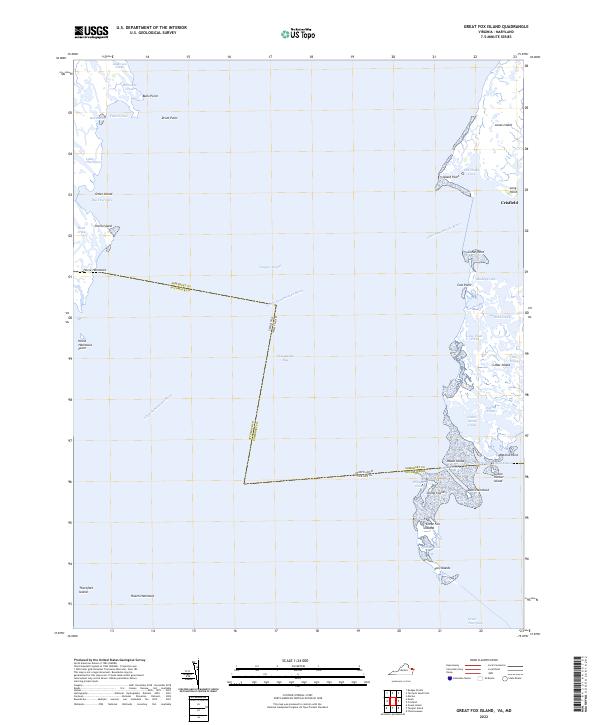
2022 Map of Great Fox Island
USGS Topo · Published 2022About this map
Tangier Sound and the Chesapeake Bay dominate this coastal landscape, where the state boundary between Virginia and Maryland cuts through open water and salt marshes. The map documents a complex archipelago of islands and tidal guts, including the southern reaches of Smith Island with its settlement at Horse Hammock. To the east, the port of Crisfield sits at the edge of the Little Annemessex River, serving as a gateway to the surrounding wetlands and islands like Janes Island and Cedar Island.
Find a feature on this map
48 named features on this map. Tap any name to fly to it.
Don’t see what you’re looking for? This feature index may not catch every label — zoom into the map to look around manually.
Map Details
Editions of this 2022 Great Fox Island Map
This is the sole edition of this map. No revisions or reprints were ever made.
Other maps of this area

1898 · St. Marys
USGS Topo · 1:125,000

1903 · Crisfield
USGS Topo · 1:62,500

1903 · Bloodsworth Island
USGS Topo · 1:62,500

1903 · Deal Island
USGS Topo · 1:62,500

1906 · St. Marys
USGS Topo · 1:125,000

1917 · Ewell
USGS Topo · 1:62,500

1920 · Crisfield
USGS Topo · 1:62,500

1942 · Chesconessex
USGS Topo · 1:31,680

1942 · Terrapin Sand Point
USGS Topo · 1:24,000

1942 · Kedges Straits
USGS Topo · 1:24,000