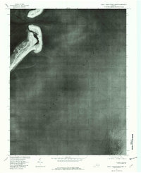
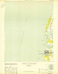
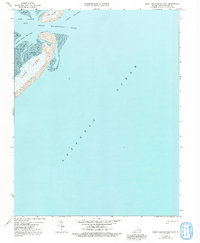
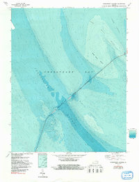
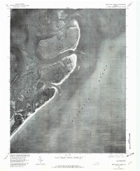
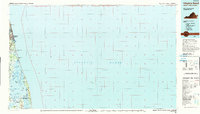
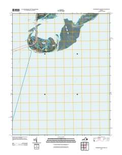
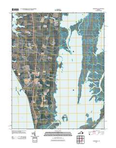
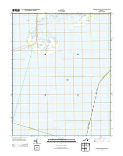
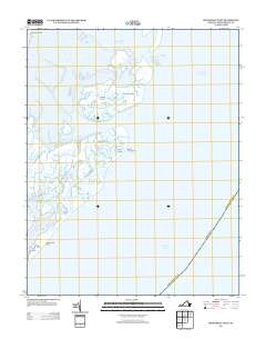
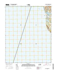
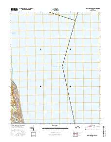
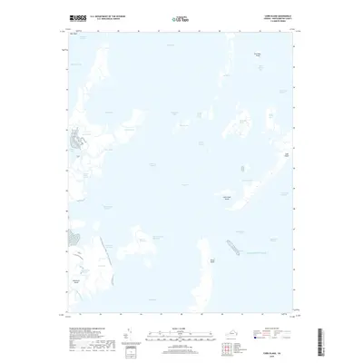
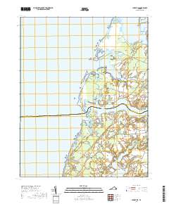
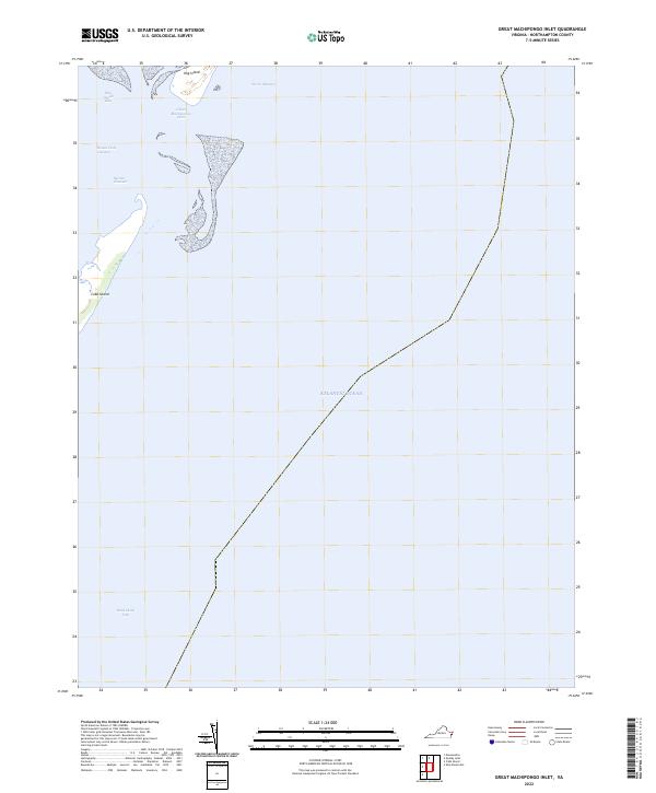
1978 Map of Great Machipongo Inlet
USGS Topo · Published 1982About this map
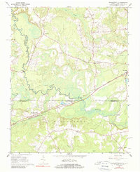
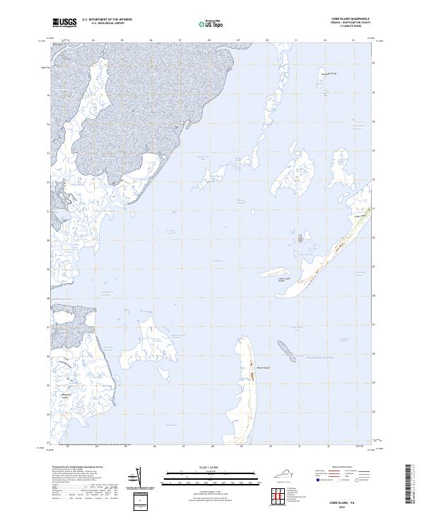
Cobb Island and the southern tip of Hog Island dominate this 1978 orthophotoquad, showing the dynamic shifting sands of Virginia's Eastern Shore. This imagery, captured by the U.S. Geological Survey in cooperation with the Soil Conservation Service, provides a literal photographic record of the barrier island morphology before the influence of later decades. The deep passage of Great Machipongo Inlet separates the two landmasses, serving as the primary connection between the restless Atlantic Ocean and the more sheltered waters of Hog Island Bay. For those studying coastal erosion or the maritime history of Northampton County, this map records the precise footprint of these ever-changing landforms as they stood in the late seventies.
Find a feature on this map
5 named features on this map. Tap any name to fly to it.
Don’t see what you’re looking for? This feature index may not catch every label — zoom into the map to look around manually.
Map Details
Editions of this 1978 Great Machipongo Inlet Map
This is the sole edition of this map. No revisions or reprints were ever made.
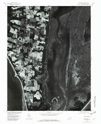
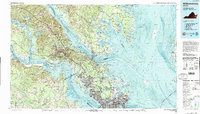
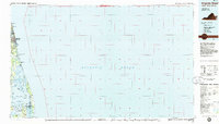
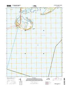
Historical Maps of Northampton County Through Time
74 maps found

1893 Virginia Beach
Northampton County, VA

1941 Broadwater
Northampton County, VA

1942 Cobb Island
Northampton County, VA
1942 Great Machipongo Inlet
Northampton County, VA
1943 Elliotts Creek
Northampton County, VA
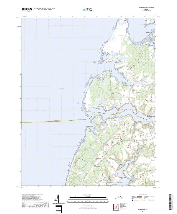
1943 Jamesville
Northampton County, VA

1943 Townsend
Northampton County, VA
1948 Wescott Point
Northampton County, VA
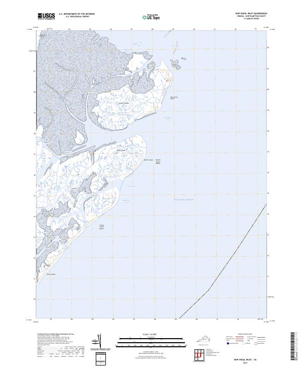
1953 Ship Shoal Inlet
Northampton County, VA

1955 Elliotts Creek
Northampton County, VA
1955 Townsend
Northampton County, VA
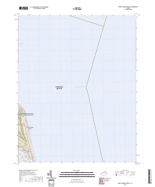
1964 North Virginia Beach
Northampton County, VA
1966 Margarettsville
Northampton County, VA
1968 Cobb Island
Northampton County, VA
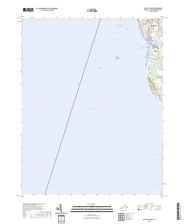
1968 Elliotts Creek
Northampton County, VA
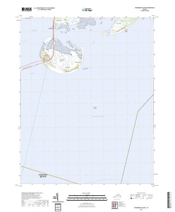
1968 Fishermans Island
Northampton County, VA
1968 Great Machipongo Inlet
Northampton County, VA
1968 Jamesville
Northampton County, VA
1968 Ship Shoal Inlet
Northampton County, VA
1968 Townsend
Northampton County, VA
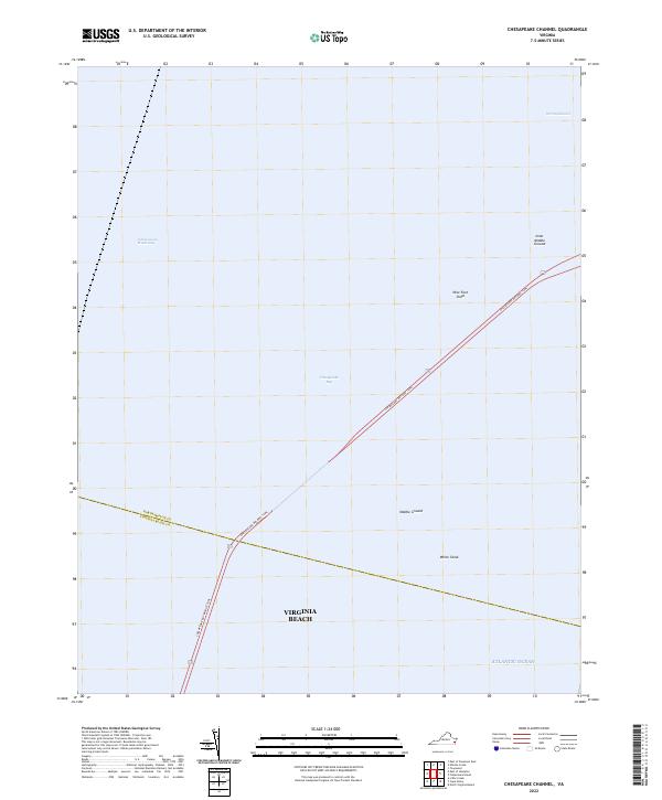
1971 Chesapeake Channel
Northampton County, VA
1977 Cobb Island
Northampton County, VA
1977 Elliotts Creek
Northampton County, VA
1977 Jamesville
Northampton County, VA
1977 Ship Shoal Inlet
Northampton County, VA
1977 Townsend
Northampton County, VA
1978 Great Machipongo Inlet
Northampton County, VA
1984 Williamsburg
Northampton County, VA
1985 Virginia Beach
Northampton County, VA
1990 Virginia Beach
Northampton County, VA
2010 North Virginia Beach
Northampton County, VA
2011 Cobb Island
Northampton County, VA
2011 Elliotts Creek
Northampton County, VA
2011 Fishermans Island
Northampton County, VA
2011 Great Machipongo Inlet
Northampton County, VA
2011 Jamesville
Northampton County, VA
2011 Ship Shoal Inlet
Northampton County, VA
2011 Townsend
Northampton County, VA
2013 Chesapeake Channel
Northampton County, VA
2013 Cobb Island
Northampton County, VA
2013 Elliotts Creek
Northampton County, VA
2013 Fishermans Island
Northampton County, VA
2013 Great Machipongo Inlet
Northampton County, VA
2013 Jamesville
Northampton County, VA
2013 North Virginia Beach
Northampton County, VA
2013 Ship Shoal Inlet
Northampton County, VA
2013 Townsend
Northampton County, VA
2016 Chesapeake Channel
Northampton County, VA
2016 Cobb Island
Northampton County, VA
2016 Elliotts Creek
Northampton County, VA
2016 Fishermans Island
Northampton County, VA
2016 Great Machipongo Inlet
Northampton County, VA
2016 Jamesville
Northampton County, VA
2016 North Virginia Beach
Northampton County, VA
2016 Ship Shoal Inlet
Northampton County, VA
2016 Townsend
Northampton County, VA
2019 Chesapeake Channel
Northampton County, VA
2019 Cobb Island
Northampton County, VA
2019 Elliotts Creek
Northampton County, VA
2019 Fishermans Island
Northampton County, VA
2019 Great Machipongo Inlet
Northampton County, VA
2019 Jamesville
Northampton County, VA
2019 North Virginia Beach
Northampton County, VA
2019 Ship Shoal Inlet
Northampton County, VA
2019 Townsend
Northampton County, VA
2022 Chesapeake Channel
Northampton County, VA
2022 Cobb Island
Northampton County, VA
2022 Elliotts Creek
Northampton County, VA
2022 Fishermans Island
Northampton County, VA
2022 Great Machipongo Inlet
Northampton County, VA
2022 Jamesville
Northampton County, VA
2022 North Virginia Beach
Northampton County, VA
2022 Ship Shoal Inlet
Northampton County, VA
2022 Townsend
Northampton County, VA