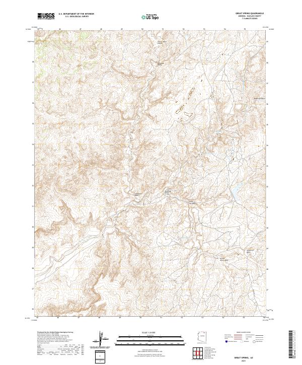
2021 Map of Great Spring
USGS Topo · Published 2021About this map
Great Spring and Sand Spring define the water resources of this high plateau in Navajo County, where the desert landscape is carved by complex drainages. The area is characterized by deep erosional features like Yellow Water Canyon and broad depressions such as Wild Ram Valley and Red Peak Valley. These landforms reveal the structural geology of the region, where seasonal flows have etched paths through Moenkopi Wash and Coal Mine Wash. Modern transit is limited to the corridor of Indian Rte 41 in the southeast, which skirts the edges of Sagebrush Wash and Juniper Grove Wash. This remote reach of the Navajo Nation remains largely undeveloped, preserving the original topographic relationships between named springs and the expansive wash systems that dictate the flow of the terrain.
Find a feature on this map
17 named features on this map. Tap any name to fly to it.
Don’t see what you’re looking for? This feature index may not catch every label — zoom into the map to look around manually.
Map Details
Editions of this 2021 Great Spring Map
This is the sole edition of this map. No revisions or reprints were ever made.
Other maps of this area

1883 · Marsh Pass
USGS Topo · 1:250,000

1892 · Marsh Pass
USGS Topo · 1:250,000

1956 · Marble Canyon
USGS Topo · 1:250,000

1959 · Marble Canyon
USGS Topo · 1:250,000

1961 · Marble Canyon
USGS Topo · 1:250,000
1968 · Owl Valley
USGS Topo · 1:24,000

1968 · Yucca Hill
USGS Topo · 1:24,000
1968 · Marsh Pass SE
USGS Topo · 1:24,000
1968 · Red Slide Peak
USGS Topo · 1:24,000

1970 · Shonto SE
USGS Topo · 1:24,000