
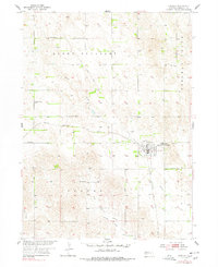
1954 Map of Greeley
USGS Topo · Published 1955About this map
Greeley (Greeley Center) serves as the hub of this Nebraska agricultural landscape, positioned where the Chicago Burlington and Quincy railroad line meets the rolling terrain of Mount Pleasant. This 1950s survey documents a well-distributed network of rural education and faith, evidenced by numerous numbered schoolhouses like School No 54 and School No 40, alongside named institutions such as Star Sch and Boston Valley Sch.
Find a feature on this map
21 named features on this map. Tap any name to fly to it.
Don’t see what you’re looking for? This feature index may not catch every label — zoom into the map to look around manually.
Map Details
Editions of this 1954 Greeley Map
Other maps of this area

1899 · Loup
USGS Topo · 1:125,000

1899 · St. Paul
USGS Topo · 1:125,000

1953 · Scotia NE
USGS Topo · 1:24,000

1953 · Scotia
USGS Topo · 1:24,000

1954 · Horace
USGS Topo · 1:24,000

1954 · Greeley NE
USGS Topo · 1:24,000

1954 · Greeley NW
USGS Topo · 1:24,000

1954 · Spalding SW
USGS Topo · 1:24,000

1954 · Wolbach
USGS Topo · 1:24,000

1954 · Spalding NW
USGS Topo · 1:24,000