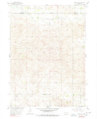
1954 Map of Greeley NE
USGS Topo · Published 1978About this map
Cedar River and Clear Creek define this rural Nebraska landscape, where the flat river bottoms give way to the rising terrain of Mount Pleasant. The map records a mid-century agricultural community organized around a network of section roads and small local institutions, including School No 23, School No 29, and School No 34. A spiritual center is found at Cedar Valley Ch, located near the northern boundary line between Wheeler and Greeley counties.
Find a feature on this map
13 named features on this map. Tap any name to fly to it.
Don’t see what you’re looking for? This feature index may not catch every label — zoom into the map to look around manually.
Map Details
Editions of this 1954 Greeley NE Map
3 editions found
Other maps of this area

1954 · Horace
USGS Topo · 1:24,000

1954 · Greeley NE
USGS Topo · 1:24,000

1954 · Greeley
USGS Topo · 1:24,000

1954 · Greeley NW
USGS Topo · 1:24,000

1954 · Spalding SW
USGS Topo · 1:24,000

1954 · Spalding NW
USGS Topo · 1:24,000

1954 · Bartlett SE
USGS Topo · 1:24,000

1954 · Ericson
USGS Topo · 1:24,000

1955 · Broken Bow
USGS Topo · 1:250,000

1956 · Broken Bow
USGS Topo · 1:250,000