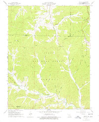
1967 Map of Greeley
USGS Topo · Published 1978About this map
Clark National Forest dominates this section of the Ozarks, where the Black River and the West Fork Black River meet near the community of Greeley. During the mid-1960s, the region saw active industrial development, evidenced by the Buick Mine and associated St Louis San Francisco rail line in the northeast corner. This industrial presence contrasts with the traditional rural landscape found throughout the hollows. Small local centers like Crossville and Henpeck remain connected by the winding Karkaghne Drive. Family and community history is preserved at sites such as New Harmony Ch, Crossville Ch, and several rural burial grounds including Barton Cem and Radford Cem. The complex drainage system of the area is defined by numerous named features like Huzzah Creek, Bucksnort Fork, and Smalls Creek, which carve through the ridges of the Sinking and Carroll districts.
Find a feature on this map
54 named features on this map. Tap any name to fly to it.
Don’t see what you’re looking for? This feature index may not catch every label — zoom into the map to look around manually.
Map Details
Editions of this 1967 Greeley Map
3 editions found
Other maps of this area

1941 · Stone Hill
USGS Topo · 1:62,500

1943 · Boss
USGS Topo · 1:62,500

1944 · Corridon
USGS Topo · 1:62,500

1945 · Stone Hill
USGS Topo · 1:62,500

1945 · Round Spring
USGS Topo · 1:62,500

1946 · Boss
USGS Topo · 1:62,500

1947 · Sinkin
USGS Topo · 1:48,000

1947 · Corridon
USGS Topo · 1:62,500

1949 · Round Spring
USGS Topo · 1:62,500

1949 · Rolla
USGS Topo · 1:250,000