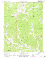
1967 Map of Greeley
USGS Topo · Published 1981About this map
The West Fork Black River and its numerous tributaries, including Huzzah Creek and Bills Creek, carve through the Missouri landscape near the borders of Dent, Iron, and Reynolds Counties. During the mid-to-late 1960s, this region within the Mark Twain National Forest saw the heavy influence of the mining industry, evidenced by the Buick Mine and Brushy Creek Mine. These industrial sites are accompanied by a large Tailings Pond and Charcoal Kilns, illustrating the deep-seated timber and mineral economy of the Ozarks.
Find a feature on this map
56 named features on this map. Tap any name to fly to it.
Don’t see what you’re looking for? This feature index may not catch every label — zoom into the map to look around manually.
Map Details
Editions of this 1967 Greeley Map
3 editions found
Other maps of this area

1941 · Stone Hill
USGS Topo · 1:62,500

1943 · Boss
USGS Topo · 1:62,500

1944 · Corridon
USGS Topo · 1:62,500

1945 · Stone Hill
USGS Topo · 1:62,500

1945 · Round Spring
USGS Topo · 1:62,500

1946 · Boss
USGS Topo · 1:62,500

1947 · Sinkin
USGS Topo · 1:48,000

1947 · Corridon
USGS Topo · 1:62,500

1949 · Round Spring
USGS Topo · 1:62,500

1949 · Rolla
USGS Topo · 1:250,000