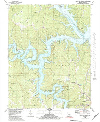
1983 Map of Green Bay Terrace
USGS Topo · Published 1983About this map
Lake of the Ozarks dominates this landscape, its deep, branching fingers like the Niangua Arm and Little Niangua River cutting through the winding ridges of Camden County. The topography is defined by sharp elevation changes, where high points like Tick Ridge and Sinkhole Ridge overlook the submerged valleys. Along the southern shorelines, the community of Neongwah and the Camdenton Towersite State Wildlife Management Area reflect a mix of conservation and rural development.
Find a feature on this map
74 named features on this map. Tap any name to fly to it.
Don’t see what you’re looking for? This feature index may not catch every label — zoom into the map to look around manually.
Map Details
Editions of this 1983 Green Bay Terrace Map
2 editions found
Other maps of this area

1888 · Versailles
USGS Topo · 1:125,000

1893 · Versailles
USGS Topo · 1:125,000

1932 · Versailles No 4
USGS Topo · 1:48,000

1933 · Stoutland
USGS Topo · 1:62,500

1934 · Macks Creek
USGS Topo · 1:48,000

1934 · Camdenton
USGS Topo · 1:24,000

1934 · Purvis
USGS Topo · 1:24,000

1934 · Irontown Ferry
USGS Topo · 1:24,000

1934 · Lake Ozark
USGS Topo · 1:24,000

1934 · Green Bay Terrace
USGS Topo · 1:24,000