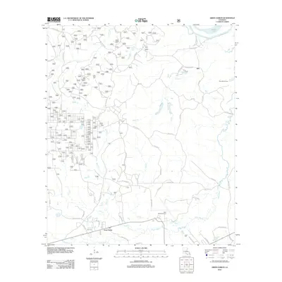
2012 Map of Green Gables
USGS Topo · Published 2012About this map
Green Gables and the surrounding piney woods and bayous near Esler Regional Airport are the focus of this 2012 topographic survey. The landscape is defined by its winding waterways, where Flagon Bayou and Little Cr snake through the southern terrain, and Little River and Walker Lake occupy the northeastern corner. Historical local markers like Clear Creek Church and Clear Creek Cem provide critical touchpoints for genealogical research in this rural portion of Louisiana.
Find a feature on this map
64 named features on this map. Tap any name to fly to it.
Don’t see what you’re looking for? This feature index may not catch every label — zoom into the map to look around manually.
Map Details
Editions of this 2012 Green Gables Map
This is the sole edition of this map. No revisions or reprints were ever made.
Other maps of this area

1936 · Pollock
USGS Topo · 1:62,500

1941 · Jena
USGS Topo · 1:62,500

1941 · Alexandria
USGS Topo · 1:62,500

1941 · Buckeye
USGS Topo · 1:62,500

1941 · Pollock
USGS Topo · 1:62,500

1953 · Alexandria
USGS Topo · 1:250,000

1955 · Alexandria
USGS Topo · 1:250,000

1957 · Alexandria
USGS Topo · 1:62,500
1957 · Alexandria
USGS Topo · 1:24,000

1958 · Pollock
USGS Topo · 1:62,500