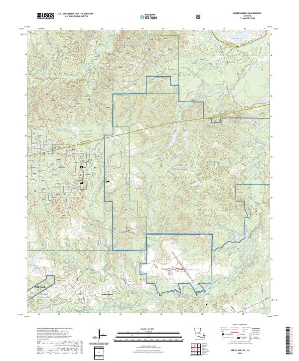
2024 Map of Green Gables
USGS Topo · Published 2024About this map
Military installations and dense pine woods define this landscape on the border of Grant and Rapides Parishes. NG Camp Beauregard and the expansive NG Beauregard Training Range occupy a significant portion of the terrain, illustrating the long-standing importance of this region for national defense operations. Further south, NG Esler Field and the Esler Regional Airport emphasize the area's aviation infrastructure.
Find a feature on this map
57 named features on this map. Tap any name to fly to it.
Don’t see what you’re looking for? This feature index may not catch every label — zoom into the map to look around manually.
Map Details
Editions of this 2024 Green Gables Map
This is the sole edition of this map. No revisions or reprints were ever made.
Other maps of this area

1936 · Pollock
USGS Topo · 1:62,500

1941 · Jena
USGS Topo · 1:62,500

1941 · Alexandria
USGS Topo · 1:62,500

1941 · Buckeye
USGS Topo · 1:62,500

1941 · Pollock
USGS Topo · 1:62,500

1953 · Alexandria
USGS Topo · 1:250,000

1955 · Alexandria
USGS Topo · 1:250,000

1957 · Alexandria
USGS Topo · 1:62,500
1957 · Alexandria
USGS Topo · 1:24,000

1958 · Pollock
USGS Topo · 1:62,500