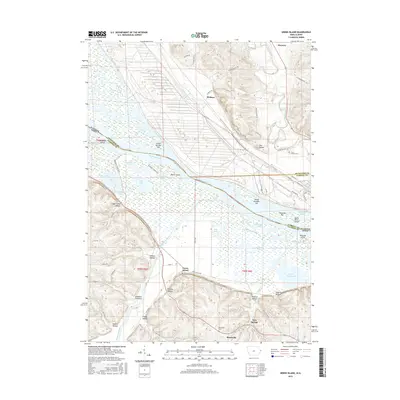
2015 Map of Green Island
USGS Topo · Published 2015About this map
The Mississippi River creates a complex network of backwaters and islands where the Maquoketa River and Apple River converge along the Illinois-Iowa border. This 2015 survey details the riverine landscape near Hanover, showing the numerous named sloughs and lakes that define the bottomlands, such as Crooked Slough and Fish Lake. On the higher ground east of the river, small settlements like Whitton and Reeceville are linked by a grid of rural roads, including W Depot Rd and Green Island Rd. The map preserves the location of historic burial grounds like Lost Mound Cem and Reeceville Cem, providing valuable spatial data for genealogists. The topography is marked by deeply incised valleys or hollows, such as Sugar Camp Hollow and Schlect Hollow, which drain the bluffs overlooking the river valley.
Find a feature on this map
75 named features on this map. Tap any name to fly to it.
Don’t see what you’re looking for? This feature index may not catch every label — zoom into the map to look around manually.
Map Details
Editions of this 2015 Green Island Map
This is the sole edition of this map. No revisions or reprints were ever made.
Other maps of this area

1892 · Savanna
USGS Topo · 1:62,500

1911 · Elizabeth
USGS Topo · 1:62,500

1911 · Galena
USGS Topo · 1:62,500

1913 · Galena
USGS Topo · 1:62,500

1935 · Miles
USGS Topo · 1:62,500

1936 · Elizabeth
USGS Topo · 1:62,500

1941 · Miles
USGS Topo · 1:62,500

1952 · Savanna
USGS Topo · 1:62,500

1953 · Blackhawk
USGS Topo · 1:24,000

1953 · Green Island
USGS Topo · 1:24,000