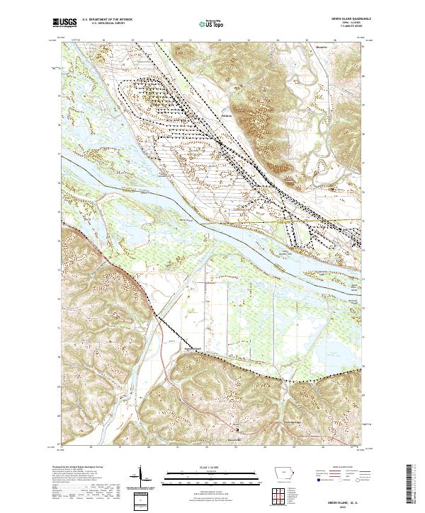
2022 Map of Green Island
USGS Topo · Published 2022About this map
The Maquoketa River converges with the Mississippi River in a complex landscape of backwater sloughs and islands along the Iowa and Illinois border. This recent survey illustrates the intricate hydraulic network that defines the region, from the wide expanse of Flat Lake and Goose Lake to the meandering paths of Snag Slough and Brickhouse Slough. The topography is sharply divided between the river bottoms and the deeply etched bluffs to the west and north, where numerous named ravines like Sugar Camp Hollow and Schlect Hollow drain toward the floodplain.
Find a feature on this map
69 named features on this map. Tap any name to fly to it.
Don’t see what you’re looking for? This feature index may not catch every label — zoom into the map to look around manually.
Map Details
Editions of this 2022 Green Island Map
This is the sole edition of this map. No revisions or reprints were ever made.
Other maps of this area

1892 · Savanna
USGS Topo · 1:62,500

1911 · Elizabeth
USGS Topo · 1:62,500

1911 · Galena
USGS Topo · 1:62,500

1913 · Galena
USGS Topo · 1:62,500

1935 · Miles
USGS Topo · 1:62,500

1936 · Elizabeth
USGS Topo · 1:62,500

1941 · Miles
USGS Topo · 1:62,500

1952 · Savanna
USGS Topo · 1:62,500

1953 · Blackhawk
USGS Topo · 1:24,000

1953 · Green Island
USGS Topo · 1:24,000