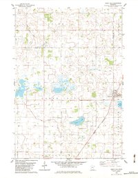
1982 Map of Green Isle
USGS Topo · Published 1983About this map
The town of Green Isle serves as the focal point of this Sibley County landscape, where the Chicago and North Western rail line cuts diagonally across the prairie. The geography is defined by a complex network of glacial remnants and drainage engineering, including Lake Severance and several former lakes that have transitioned into marshes or agriculture, such as Fahey Lakebed and Brian Lakebed. Significant efforts to manage the water table are evident through numbered waterways like Judicial Ditch No 8 and Ditch No 29. Local history and genealogy are anchored by several landmarks, including the Green Isle Cem, St Marys Cem, and country churches like St Johns Ch and Zion Ch. The transition between the townships of Helen, Green Isle, and Arlington is marked by a grid of rural roads and the High Island thoroughfare.
Find a feature on this map
29 named features on this map. Tap any name to fly to it.
Don’t see what you’re looking for? This feature index may not catch every label — zoom into the map to look around manually.
Map Details
Editions of this 1982 Green Isle Map
This is the sole edition of this map. No revisions or reprints were ever made.
Other maps of this area

1953 · Saint Paul
USGS Topo · 1:250,000

1953 · New Ulm
USGS Topo · 1:250,000

1957 · New Ulm
USGS Topo · 1:250,000

1957 · Belle Plaine
USGS Topo · 1:62,500

1957 · Waconia
USGS Topo · 1:62,500

1958 · New Ulm
USGS Topo · 1:250,000

1958 · Gaylord
USGS Topo · 1:62,500

1958 · Glencoe
USGS Topo · 1:62,500

1959 · Saint Paul
USGS Topo · 1:250,000

1967 · New Ulm
USGS Topo · 1:250,000